Historical Revisionism in the National Curriculum
by Prof Augusto Zimmerman


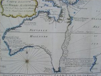
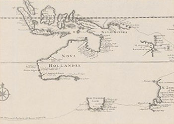
This is one of the very few pre-Cook maps showing only Australia. Produced in 1753 by Frenchman, Jacques Nicolas Bellin, the imaginary line goes from Tasmania to Espiritu Santo to PNG. The coastal note translates: I suppose that the land of Dieman can join with the land of the Holy Ghost but this is without proof."
 Enlarge
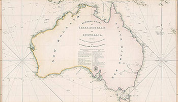
Map of Australia by Matthew Flinders of 1814. (National Library of Australia ref: nla.map-t570)
Enlarge
Tribal Map of Australia
Thinking of going on a Christian tour of historic places in Australia or New Zealand?
More information here
National Christian Heritage .
National Solemn Assembly held in Canberra in March 2007.
This timeless message is not just for Australia during the drought of 2007 but also for our present time!
Please view this 51 minute video here
01.05.2013
National Gathering (1988) video on You Tube
Watch the National Gathering (1988) video "With One Accord" on You Tube. Introduced by Kel Richards
01.05.2013
Gospel Arrives in NZ
200 years ago the Gospel arrived on the shores of New Zealand. Read what's being done to commemorate this event.